
Berghaus Schwänzelegg via Scära to the Wannenspitz
6.1 km
2:30 h
350 Hm
151 Hm

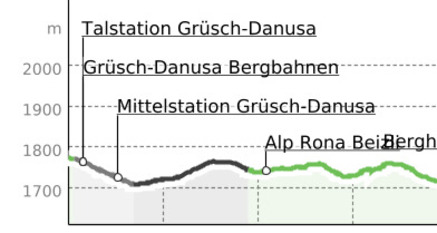
A moderately difficult long hike to the magnificent summit Wannenspitz (1970 m above sea level)
Beste Jahreszeit
Jan
Feb
Mär
Apr
Mai
Jun
Jul
Aug
Sep
Okt
Nov
Dez
Koordinaten
46.945939, 9.650202
Details
Beschreibung
On the red-white marked hiking trail we continue to Alp Rona and then to Scarä. Between the two alpine huts, the path climbs up to the eastern ridge of the Wannenspitz, here partly pathless over the ridge upwards to the summit. The return journey takes practically the same time as the ascent.
Geheimtipp
sign the summit register


Verantwortlich für diesen Inhalt Prättigau Marketing.

Diese Webseite nutzt Technologie und Inhalte der Outdooractive Plattform.