
Kirchlispitzen (Rätikon West)
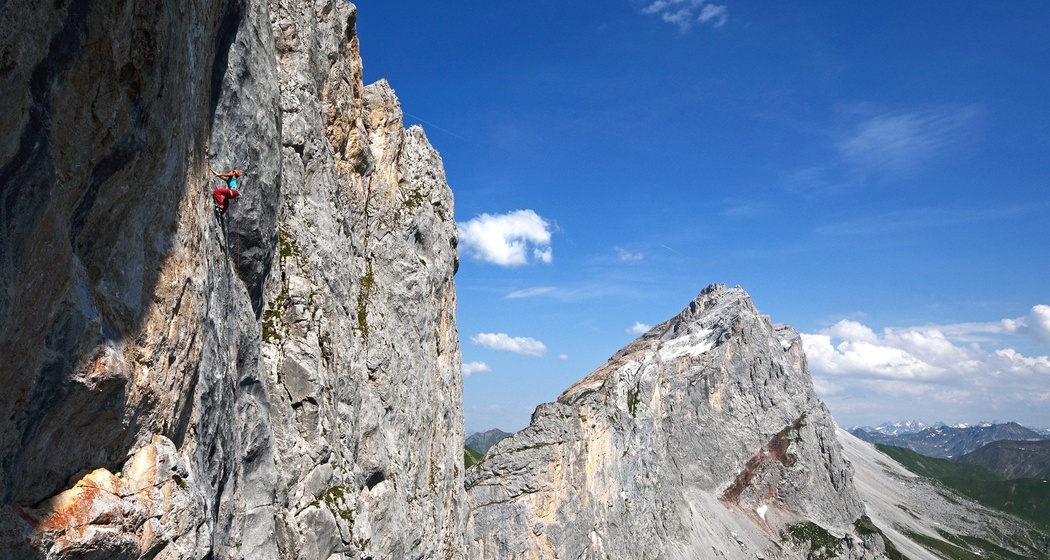
Nearly 2.5 km long rock ridge between Cavelljoch and Schweizertor, named after the Chilchli, a rock pinnacle above the Cavella Alps.
Details
Beschreibung
In this border ridge, 7 peaks are counted, numbered from west to east. To the south, these peaks drop off in 150 – 350 m high rock walls. More than 50 climbing routes, from the classic crossing of all peaks (2 to 3) to the route Silbergeier (10), offer a vast climbing selection. The major classics: Pardutzerweg (8–), Galadriel (8–), Via Andres (7–).
Sicherheitshinweis
You are personally responsible for your safety! You use the routes at your own risk - creators disclaim any liability. Insurance coverage is the responsibility of each individual.
Ausrüstung
The extent of climbing equipment needed depends, among other things, on the route to be completed. Climbing guides mostly provide route-specific information on the additional material to be taken along.
Anfahrt
Anreise Information
Parken
Verantwortlich für diesen Inhalt Prättigau Marketing.

Diese Webseite nutzt Technologie und Inhalte der Outdooractive Plattform.