
Laaxer Stöckli
Schwer
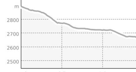
2.2 km
0:30 h
0 Hm
327 Hm
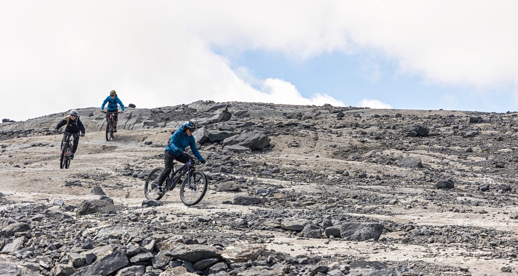
You've reached the maximum altitude! You have to earn this alpine trail. You'll be rewarded with a spectacular view and a thrilling descent.
Beste Jahreszeit
Jan
Feb
Mär
Apr
Mai
Jun
Jul
Aug
Sep
Okt
Nov
Dez
Start
Laaxer Stöckli
Ziel
Restaurant Vorab
Koordinaten
46.882966, 9.202698
Details
Beschreibung
The approach to the summit of the Laaxer Stöckli demands a lot from you – after all, you've already pedaled quite a way up before the final ascent. However, everything except the last few meters is rideable. Once you reach the top, the panorama will likely take your breath away. The view of the surrounding Grisons mountains from here is breathtaking. A clear case for a "selfie with a view."
Now full concentration is required: The descent starts off very technical on the blue-white marked hiking trail, which soon becomes somewhat easier (red-white marked trail). All too soon, you'll be back at the Vorab restaurant (closed in summer). Continue your descent directly on the Vorab Trail – and if you have fresh brake pads and strong legs, you'll descend another almost 2000 meters all the way down to the Rhine.
Sicherheitshinweis
The weather in the Alps can change quickly: to be on the safe side, pack a rain jacket and a warm layer.
Fairtrail: Give way to hikers.
Ausrüstung
Backpack with first aid kit, bike repair kit and snacks.
Anfahrt
Öffentliche Verkehrsmittel
Take the train to Chur and then the post bus to Flims, Bergbahnen (to access the uphill starting from Nagens Sura).
Anreise Information
Take the A13 motorway to Chur and continue to exit no. 18 "Reichenau". From there, head towards Flims. Use the "Stenna" car park at the Flims valley station.
Parken
Parking "Stenna", Flims.
Verantwortlich für diesen Inhalt Flims Laax Falera Management AG.

Diese Webseite nutzt Technologie und Inhalte der Outdooractive Plattform.