
From St. Antönien to the Carschina Hut

Leicht
7.6 km
3:05 h
809 Hm
3 Hm
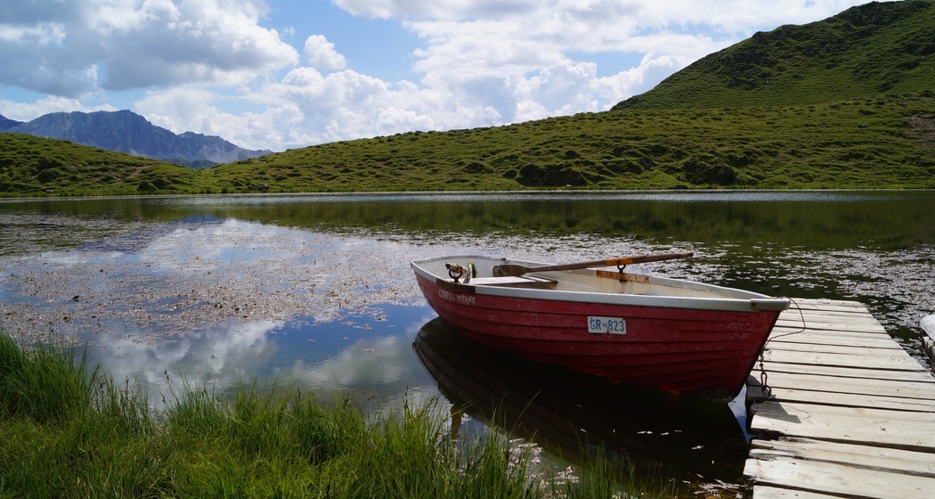
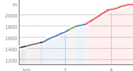
Pleasant approach to the Carschina Hut, a very scenic route with a visit to the Carschina Lake
Beste Jahreszeit
Jan
Feb
Mär
Apr
Mai
Jun
Jul
Aug
Sep
Okt
Nov
Dez
Start
Dorfplatz St. Antönien
Ziel
Carschina Hut
Koordinaten
46.969662, 9.813404
Details
Beschreibung
Dorfplatz St. Antönien, starting point for the hut approach to the Carschina Hut. Via a wide hiking trail it goes up to the Meierhofer Älpli below the Chüenihorn. To save time and elevation meters, the Bus alpin runs from the end of June to mid-August and then on weekends until mid-October up to Bärgli. Along the mountain flank, high above the valley, one reaches a high plateau. The signpost shows that we have arrived just behind the Carschina Lake (observe the signpost to the lake). Following the contour, one shortly afterwards reaches the Carschina Pass. Our destination is just a few steps away.
Geheimtipp
Pleasant hut approach. The highlight is a swim in the Carschina Lake!
Wegbeschreibung
St. Antönien - Meierhofer Älpli - Carschina Lake - Carschina Pass - Carschina Hut
Anfahrt
Öffentliche Verkehrsmittel
By the Rhaetian Railway RhB to Schiers (90.218) or Küblis (90.222) and by PostBus to St. Antönien.
Anreise Information
On the A13 to Landquart, then on the B28 to Küblis, then follow Luzeinerstrasse turning left (northwards) up to Pany.
Parken
In St. Antönien all parking spaces are subject to a fee. Payment at the parking lots is possible with cash, Parkingpay app or Twint. The P2 parking lot is located in the village center, just behind the church.


Verantwortlich für diesen Inhalt Prättigau Marketing.

Diese Webseite nutzt Technologie und Inhalte der Outdooractive Plattform.