
Pass di Passit - Trail Running
Do you want to explore the northernmost part of the Calanca Valley? Then from Passi di Passit follow the path that leads to Valbella before finishing your run in Rossa.
Details
Beschreibung
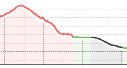
The first part of the route, up to the Pass di Passit, follows that of the "San Bernardino Strada Alta" circuit. From the highest point of the trail, continue towards Alp de Lögna descending through the Val di Passit. Once the Calancasca river is reached, continue towards the village of Valbella before arriving at Rossa. A postal bus journey allows you to return to San Bernardino comfortably.
Sicherheitshinweis
https://www.protectiondestroupeaux.ch/it/map/
Anfahrt
Öffentliche Verkehrsmittel
Rail and postal bus connections make San Bernardino easily accessible from both the south (via Bellinzona) and the north (via Chur).
Travel times:
from Lugano: about 1h30
from Zurich: about 3h
from Milan: about 2h30
Find the best connections on:
The starting point is only 5 minutes on foot from the "San Bernardino, Posta" stop.
Anreise Information
San Bernardino is easily reachable thanks to motorway connections from the north A3 Zurich – Sargans and A13 Sargans – San Bernardino and from the south A2 Chiasso – Bellinzona and A13 Bellinzona – San Bernardino.
Travel times:
from Lugano: 1h
from Zurich: 2h
from Milan: 2h
For traffic information:
Parken
It is possible to use the parking spaces available at the San Bernardino Hostel and Nordic Centre.


Verantwortlich für diesen Inhalt Ente Turistico Regionale del Moesano (ETRM).
Dieser Inhalt wurde automatisiert übersetzt.

Diese Webseite nutzt Technologie und Inhalte der Outdooractive Plattform.